
Experts from the Wrocław University of Science and Technology and the Institute of Meteorology and Water Management-National Research Institute will expand the digital precipitation atlas

Experts from the Wrocław University of Science and Technology and the Institute of Meteorology and Water Management – National Research Institute (IMGW-PIB) will expand the digital precipitation atlas with data from 2016-2025 and variables related to climate change. The updated version of the atlas will aid in designing infrastructure resilient to weather phenomena, the Wrocław university announced on Wednesday.
Specialists from the Institute of Meteorology and Water Management - National Research Institute ( IMGW-PIB ) and scientists from the Faculties of Environmental Engineering and Mathematics of the Wrocław University of Science and Technology will work on expanding the digital atlas of reliable precipitation PMAXTP, Michał Ciepielski from the press office of the Wrocław University of Science and Technology told PAP on Wednesday.
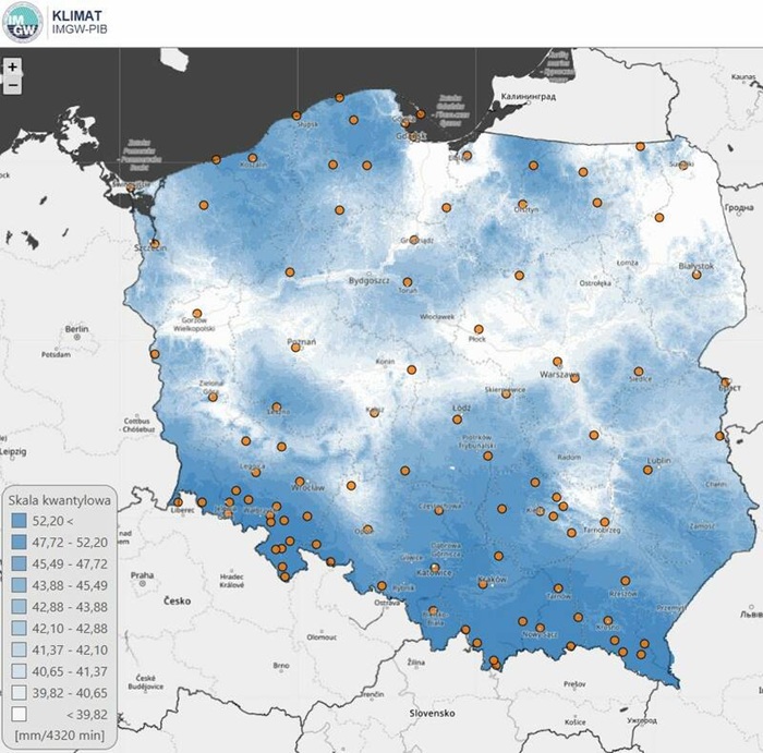
PMAXTP is a digital tool containing data on maximum precipitation at any location throughout Poland. The atlas incorporates probabilistic models and data from 100 measurement stations located throughout the country. The initial version of the atlas was created in 2022 and was based on data from 1986–2015. The tool will now be updated to include data from 2016–2025 and variables related to climate change. The project was supported by PLN 1.5 million under the European Funds for Infrastructure, Climate, and Environment (FEnIKS) program.
Prof. Bartosz Kaźmierczak, Dean of the Faculty of Environmental Engineering at Wrocław University of Science and Technology, emphasized that reliable rainfall information is crucial in many fields of engineering and water management. "The atlas is available as a public data resource, open to everyone, and its content particularly serves a broad audience in both the public and private sectors," he pointed out.
Specialist users of PMAXTP include engineers designing stormwater drainage systems, road and track drainage, and more. Architects, spatial and landscape planners, and local government officials also utilize the atlas. "Without the data from the atlas, it would be impossible to properly and safely dimension closed and open sewer systems, retention reservoirs, and associated technological systems, such as pumping stations," added Professor Kaźmierczak, quoted in the press release.
The Dean of the Faculty of Environmental Engineering at Wrocław University of Science and Technology emphasized that the new, expanded version of the PMAXTP atlas will also support water and sewage utilities and contractors in the sanitary engineering industry. "The new version will include components such as modeled precipitation, climate change projections, and unified design guidelines that will facilitate communication between government bodies and the industrial environment," the professor emphasized.
Dr. Marcin Wdowikowski, Eng., from the Department of Water, Sewage Management, and Waste Management Technology, emphasized that the primary task of the project is to update the atlas with the latest rainfall data from 2016–2025 and advanced mathematical analysis methods. "Next, we will focus on developing model rainfall data that will include information on typical, local time histories of maximum rainfall, necessary for numerical analyses of hydrodynamic modeling," explained Dr. Wdowikowski.
The next step will be to incorporate climate change scenarios into precipitation characteristics. This, the scientists emphasized, will allow for the design of infrastructure that will be effective and resistant to extreme weather events in the coming decades.
As part of the project, the PMAXTP digital atlas platform will also be expanded to make it more intuitive and interactive.
Wrocław University of Science and Technology emphasized that IMWM-PIB is playing a leading role in the project. Experts from this institution are responsible for providing and verifying measurement data. IMWM-PIB will also update the atlas with measurement data from 2016–2025. Scientists from the Wrocław university will be responsible for the project's innovative elements.
"We will process precipitation data using advanced probabilistic models, which will be used to generate model precipitation. Our work is particularly important in the context of incorporating forecast data into the atlas based on climate change scenarios," explained Dr. Wdowikowski.
The project is scheduled for completion in mid-2028. (PAP)
pdo/ agt/
The PAP Foundation permits free reprinting of articles from the Nauka w Polsce website, provided that you notify us by email once a month of your use of the website and cite the source of the article. On portals and websites, please include the linked address: Source: naukawpolsce.pl, and in journals, please include the annotation: Source: Nauka w Polsce website - naukawpolsce.pl. This permission does not apply to information in the "World" category or any photographs or video materials.
naukawpolsce.pl


