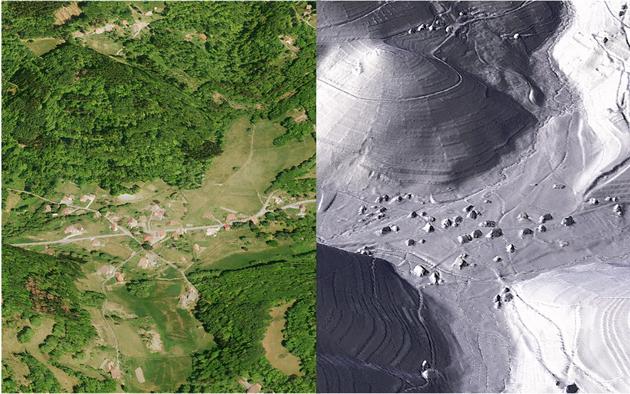
Archaeology in the age of LiDAR revelations


The word "LiDAR" is still little known to the general public. Unless, perhaps, we are talking about the lost cities found under the canopy in Cambodia or Central America , thanks to the scanning, from the sky, of a laser beam that passes through gaps in the foliage. This technology, adopted for about twenty years by archaeologists, is shaking up their discipline, but not only in equatorial or tropical forests. "Here, we have the same thing, even if they are not pyramids!" , emphasizes archaeologist Murielle Leroy, a pioneer in the use of LiDAR for archaeological purposes in French forests in the late 2000s. "It was a revolutionary technology, and it still is," she assures.
In France, the National Geographic Institute (IGN) is well advanced in its full coverage of the territory. Each new data harvest, each new quadrilateral covered, is eagerly awaited by archaeologists. This coverage puts the country on par with some of its neighbors, who had invested earlier in LiDAR. Finally, the European continent has taken the measure of its interest in the recognition, study and protection of archaeological heritage: as an indication of the maturity of this tool, the European Archaeological Council published, on March 25, a guide to its proper use for the scientific community .
You have 91.08% of this article left to read. The rest is reserved for subscribers.
Le Monde


